Nova Scotia

This article was originally published by the Halifax Examiner on November 28, 2021.

Sign on Highway 4 in Cape Breton advertising waterfront for sale on the Bras d'Or Lake. Photo by Joan Baxter

Photo: Joan Baxter

Nova Scotia has long been a popular place not just for settlers, but in the last century it also became a popular place for non-residents — including many well-heeled Americans and Europeans — to purchase properties.[1]

For decades, scholars and successive governments have debated the issue of non-resident land ownership in a province with relatively little Crown land, with waterfronts being carved up into private properties that reduce public access to Nova Scotia shorelines.

The COVID-19 pandemic has caused a real estate boom in Nova Scotia, including most rural counties, as people from urban centres, elsewhere in Canada and abroad, looked for ways to escape crowded urban areas.

A few months into the pandemic, the German magazine, Der Spiegel, broke the story that some right-wing conspiracy theorists were marketing Cape Breton to like-minded German-speaking Europeans, which added yet another dimension to long-standing questions about non-resident land ownership in Nova Scotia.

This three-part series follows up on its 2020 coverage and looks into some of these questions it raises, even as the province prepares to change the property tax rate for non-resident owners.

This, the final of three articles, looks at previous efforts to come to grips with the question of land ownership regulation in Nova Scotia, what it means for affordability of properties, and why it’s all been so contentious for so long.

Read part 1 here.

Read part 2 here.

Stunning white rock shoreline near Terence Bay. Photo by Joan Baxter

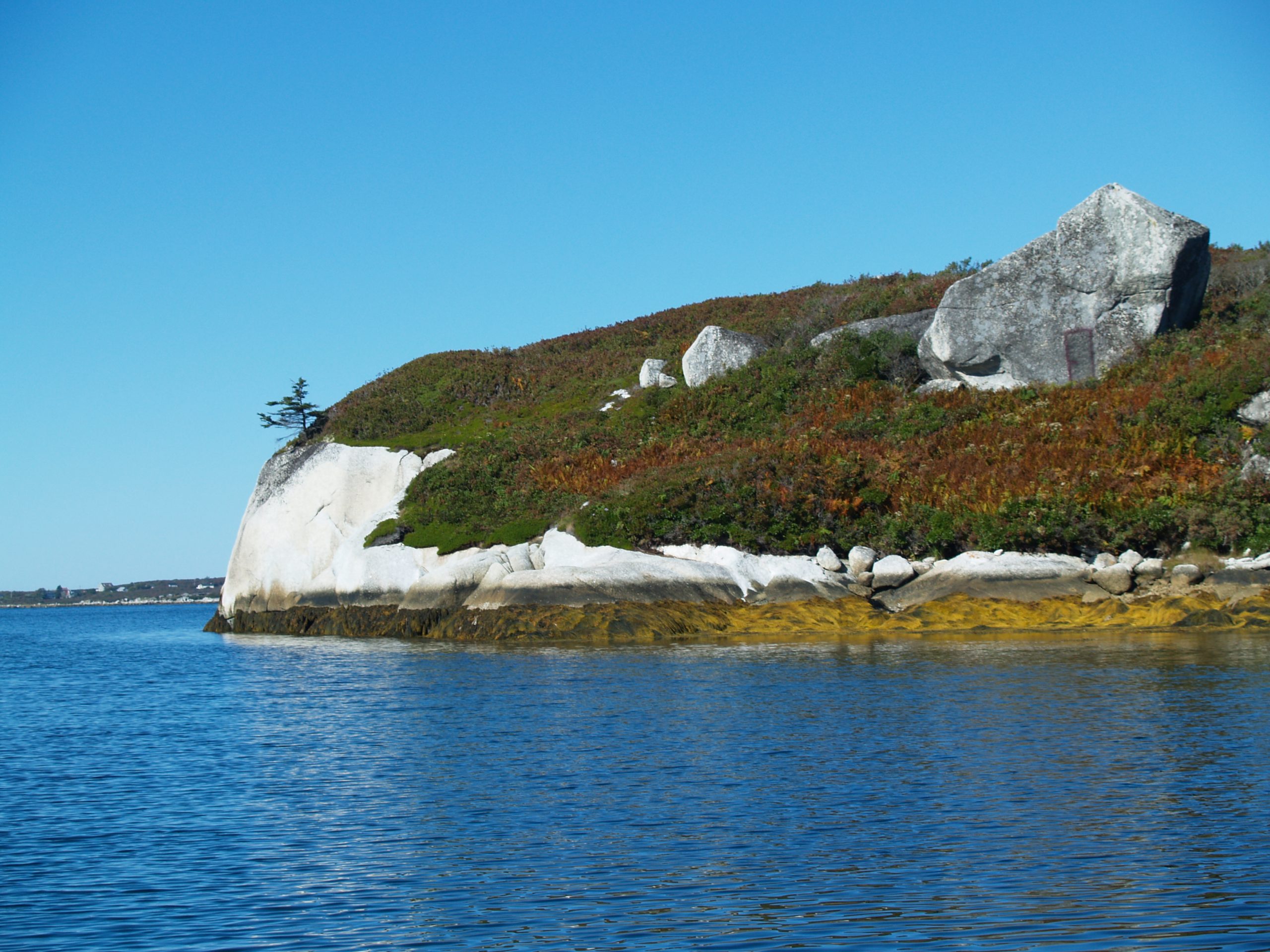
Nova Scotia coastline near Terence Bay. Photo: Joan Baxter

It was a spring day, and as they’d been doing for some weeks, Jan and Paul (not their real names) were driving around looking for land on the South Shore of Nova Scotia, where Jan had spent a good part of her childhood.

Both were living and working in Halifax, and wanted a property they could call their own, where they would settle down and eventually retire. They had been scouting out properties for weeks, and had yet to find a place they could afford. For many years, the South Shore had been popular with American and European buyers who had no problem paying hefty prices for oceanfront properties.

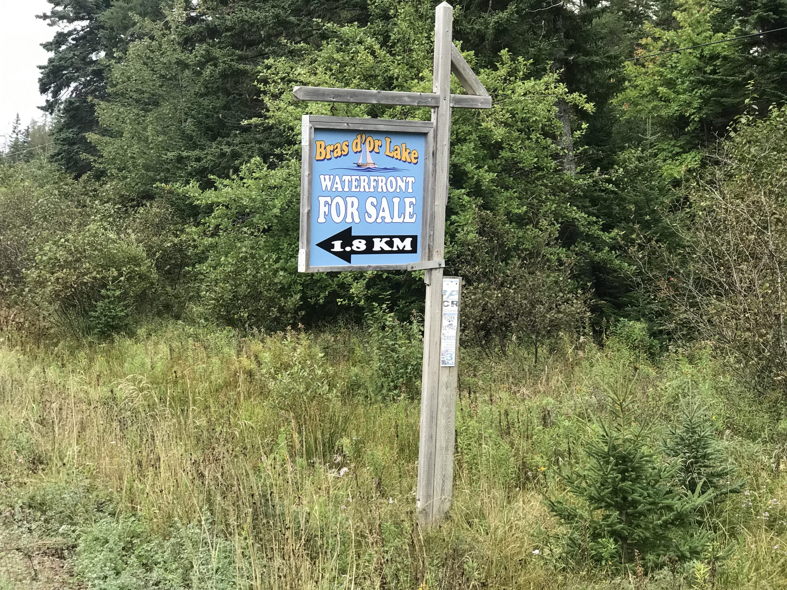
“One day we were driving out near Terence Bay,” Jan recalled for the Halifax Examiner. “And we saw this sign that said ‘lots for sale’ on a dirt road that seemed to lead to the waterfront. So we just started driving. The gate was open.”

Suddenly another vehicle came out of nowhere and cut them off. The woman driver stopped her car, slammed the door, and approached their open window, angrily informing them they were on private property.

“We said we were sorry but that we had seen a sign that there were lots for sale, and we told her we were potential buyers,” Jan said.

The woman, who had a strong German accent, was still angry, and proclaimed loudly, “We don’t sell to Canadians.”

She said the lots were only for Europeans.

Jan and Paul turned around and headed back to the main road.

Jan, a fifth generation Nova Scotian, was in tears.

This happened back in the mid-1990s, but Jan remembers it as if it were yesterday, especially her visceral reaction to being told that Canadians were not welcome to buy land in … Nova Scotia.

A new tax levy for non-residents?

Non-resident land ownership in Nova Scotia has been a contentious issue for decades.

Canadian Pioneer Estates billboard in Richmond County, Cape Breton. Photo by Joan Baxter

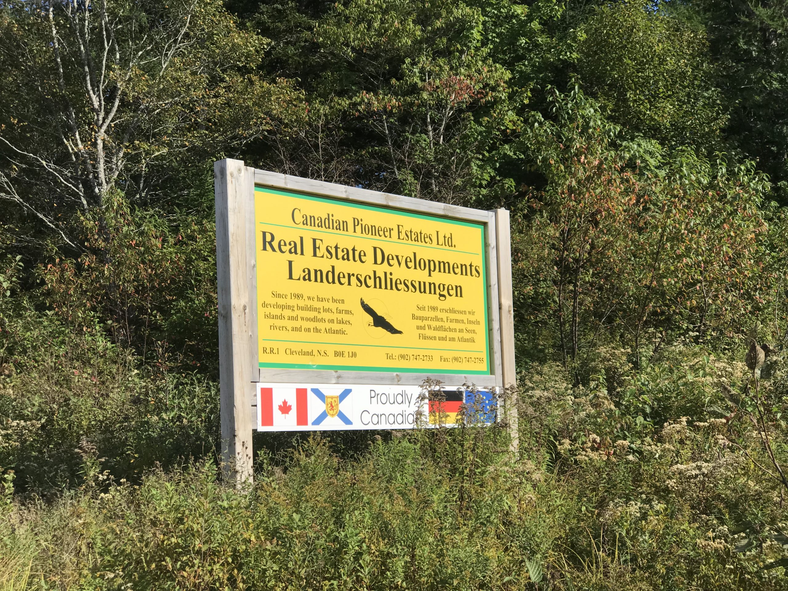
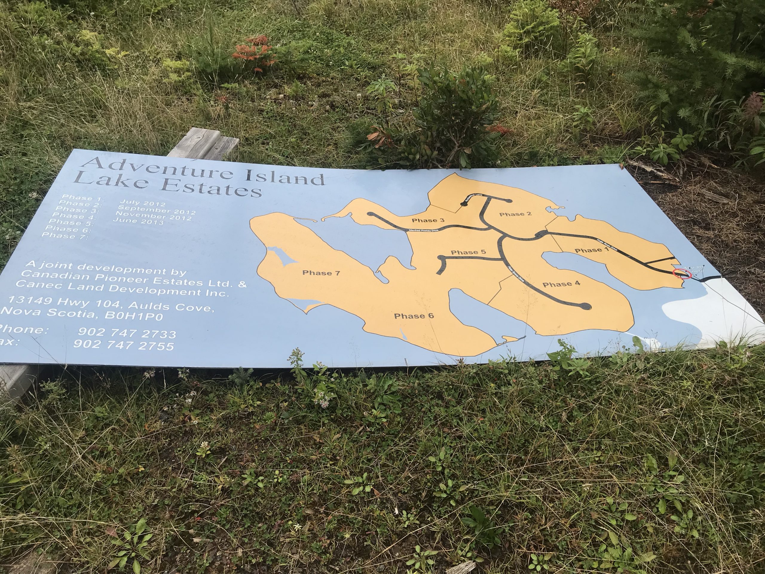
Canadian Pioneer Estates sign in Richmond County, Cape Breton. Photo: Joan Baxter

The question of whether those who own land, reside and pay taxes in Nova Scotia should pay lower property taxes than those who do not has been debated, discussed, and disagreed on since the 1960s. Continue reading “Please don’t sell Nova Scotia:” Additional taxes on non-resident landowners have been discussed since the 1960s. Now the debate is on again as non-residents snap up property in Cape Breton.

Read more

This article was originally published by the Halifax Examiner on November 23, 2021. Note that since it was first published, Frank Eckhardt who is featured in this article, has been arrested twice in Cape Breton, once on extortion charges, and a second time for a slew of firearms offences.

Sign on Highway 4 in Cape Breton advertising waterfront for sale on the Bras d'Or Lake. Photo by Joan Baxter

Photo: Joan Baxter

Nova Scotia has long been a popular place for settlers, but in the last century it also became a popular place for non-residents — including many well-heeled Americans and Europeans — to purchase properties.[1]

For decades, scholars and successive governments have debated the issue of non-resident land ownership in a province with relatively little Crown land, and waterfronts being carved up into private properties that reduce public access to Nova Scotia shorelines.

The COVID-19 pandemic has caused a real estate boom in Nova Scotia, including most rural counties, as people from urban centres, elsewhere in Canada and abroad, looked for ways to escape crowded areas.

A few months into the pandemic, the German magazine, Der Spiegel, broke the story that some right-wing conspiracy theorists were marketing Cape Breton to like-minded German-speaking Europeans, which added yet another dimension to long-standing questions about non-resident land ownership in Nova Scotia.

In this three-part series, the Halifax Examiner follows up on its 2020 coverage of this issue, and looks into some of the complex questions it raises, even as the province prepares to change the property tax rate for non-resident owners.

Read Part 1 here.

This second article looks at more of the real estate and land development companies or individuals marketing Cape Breton Island to German speakers, and at how the trend developed.

Evans Island bridge with gate. Photo by Joan Baxter

Evans Island bridge with gate. Photo: Joan Baxter

It would be easy to miss the turn-off to the island that juts out into the Bras d’Or Lake at Hay Cove in Cape Breton.

The only indication it’s there is an innocuous sign on the edge of Highway 4 in Richmond County that advertises “waterfront” for sale. If you follow the arrow on the sign, you’ll go about a kilometer on a dirt road to a gated bridge that leads to an island.

On the island side of the bridge is a road sign that indicates that you are now on Katja Rose Drive. Just past that is a large notice that trespassing and hunting are forbidden, which advises that the island and its roads are private property.

Sign for Katja Rose Drive on Evans Island. Photo by Joan Baxter

Katja Rose Drive on Evans Island. Photo: Joan Baxter

But the “waterfront for sale” sign did seem like an invitation to visit, so it seems OK to continue along Katja Rose Drive to see what is on the market.

On either side of the gravel road are small signs fastened to trees indicating lot numbers, some with small red “sold” signs in the trees. There are also some clearings with mobile homes on them.

One lot bears a “For Sale / zu verkaufen” sign with the name and contacts for a couple in Germany. For the three-acre property, the couple are asking $96,000, the price they paid for it. There is no well or septic system on the lot, and they tell a person who recently inquired about the property that there is a high risk around the Bras d’Or Lake of drilling a well and not finding good drinking water.

Further along Katja Rose Drive there is a large billboard that has fallen down on the side of the road, which lays out the development phases of subdivision called “Adventure Island Lake Estates,” a joint venture by Canadian Pioneer Estates and Canec Land Development Inc.

This photo shows a fallen-down signboard for the Evans Island development plan. Photo by Joan Baxter

Evans Island development plan. Photo: Joan Baxter

Welcome to Evans Island.

It has been carved into 129 lots, most about two acres, nearly all of them purchased by non-resident Germans. Continue reading Developers are selling off Cape Breton, one subdivision after the other, to German-speaking non-residents? What — if anything — is wrong with that?

Read more

This article was originally published by the Halifax Examiner on November 19, 2021.

Sign on Highway 4 in Cape Breton advertising waterfront for sale on the Bras d'Or Lake. Photo by Joan Baxter

Photo: Joan Baxter

Nova Scotia has long been a popular place for settlers, but in the last century it also became a popular place for non-residents — including many well-heeled Americans and Europeans — to purchase properties.[1]

For decades, scholars and successive governments have debated the issue of non-resident land ownership in a province with relatively little Crown land, and waterfronts being carved up into private properties that reduce public access to Nova Scotia shorelines.

The COVID-19 pandemic has caused a real estate boom in Nova Scotia, including most rural counties, as people from urban centres, elsewhere in Canada, and abroad looked for ways to escape crowded areas.

A few months into the pandemic, the German magazine, Der Spiegel, broke the story that some right-wing conspiracy theorists were marketing Cape Breton to like-minded German-speaking Europeans, which added yet another dimension to longstanding questions about non-resident land ownership in Nova Scotia.

This three-part series follows up on the 2020 coverage of this issue, and looks into some of the complex questions it raises, even as the province prepares to change the property tax rate for non-resident owners. The first of the three articles updates the story of conspiracy-minded German speakers promoting Cape Breton as a refuge.

This photo shows the gravel road into the Beaver Lake Estates properties that Golden Lake Estates has been selling to people in Germany over the past two years. Photo by Joan Baxter

Beaver Lodge Estates road. Photo: Joan Baxter

The new subdivision is called Beaver Lodge Estates, and at this point, it’s little more than a gravel road carved into the scrubby woodlands near Cleveland in Richmond County, Cape Breton, about a 15-minute drive east from Port Hawkesbury.

Google Maps Screen Shot showing Beaver Lodge Estates in its first phase

Google Maps Screen Shot showing Beaver Lodge Estates in its first phase

The 57 lots in the Beaver Lodge Estates — where no beaver lodge is visible, by the way — are very basic. And that’s being generous.

Some are still marked only by signs bearing lot numbers affixed to trees. Some are small clearings with no septic system or water supply, accessed by a driveway branching off the two-kilometre-long gravel road that has been driven through the wooded landscape.

Beaver Lodge Estates road in Richmond County, Cape Breton (Contributed)

Beaver Lodge Estates road in Richmond County, Cape Breton (Contributed)

So far, just four of the lots have homes on them, and only two of those are occupied.

This photo shows a Beaver Lodge Estates lot with prefab house. Photo by Joan Baxter

Beaver Lodge Estates lot with prefab house. Photo: Joan Baxter

The land development company behind the venture, Golden Lake Estates, says it is selling off the lots in phases.

Golden Lake Estates website showing Beaver Lodge Phase II. Screen Shot from September 30, 2021.

Golden Lake Estates website showing Beaver Lodge Phase II. Screen Shot from September 30, 2021.

“After the first and second phase of Beaver Lodge Estates were so well received, we were able to continue this development with the third phase and thus 16 more properties,” says the blurb on the website of Golden Lake Estates, the new name for the company that emerged after an “amalgamation” of Cape Breton Real Solutions in September 2020, which attracted negative press coverage in July and August that year.

More on that later, but first a look at who is snapping up Golden Lake Estates properties, and at what price. Continue reading Marketing Cape Breton as a “refuge” for “clear thinkers.” Development companies selling properties to German-speaking non-residents who “want to live with the values of Germany from 1933 to 1945.”

Read more

The making of a toxic mess and the uncalculated cost of previous gold rushes

Toxic tailings from previous gold rush at Montague Mines in Halifax Regional Municipality remain exposed, and recreational users are exposed to them. Photo: Joan Baxter

This is Part 1 of a three-part story, an earlier version of which appeared in March 2020 in the Halifax Examiner, about the toxic legacy from historic gold mines in Nova Scotia, which its citizens will be paying many millions of dollars to try to clean up, and how the contamination at just one of these sites — Montague Mines in Halifax Regional Municipality (HRM) — is still affecting lives today, and may also affect a large new residential subdivision that is proposed for nearby Port Wallace, between the Highway 107 extension and Waverley Road. 

It’s a complicated mess, with a lot of conflicting interests, some powerful players — the Shaw Group through its subsidiary Clayton Developments, and its president, former HRM Chief Administrative Officer Richard Butts — and different levels of government and public agencies.

It’s also been difficult to get clear answers to some straightforward questions about the situation, but I’ll get to that. 

In Part 1, we’ll set the scene with a look at gold mining in Nova Scotia and how we got to where we are. 

Historic gold mining districts in Nova Scotia

This tale begins with colonialism, with the theft of others’ lands and appropriation of natural assets that has always driven it.

In 1578, Queen Elizabeth I of England granted a patent to “adventurer” Sir Humphrey Gilbert, which gave her the right to one-fifth of any gold and silver he found in eastern North America. Gilbert’s expedition failed to make it across the ocean, so Elizabeth didn’t get her hands on any gold from what is today known as Nova Scotia.

In subsequent centuries, many settlers reported seeing gold in the province, and names such as Cap d’Or and Bras d’Or suggest that Acadians were well aware of its presence. But it wasn’t until news of the gold fever that was gripping Australia and California in the mid-1800s reached this part of the world that settlers started hunting for gold and taking its presence seriously.[1]

One of these was John Pulsiver, a farmer from what is now Chaswood in the Musquodoboit Valley. According to his own account, in 1860 Pulsiver was camping near Mooseland with three Mi’kmaq guides – James, Paul and Francis Paul. They had run out of provisions, so one of the party went off to procure supplies. Pulsiver waited in the forest, and happened to spy a piece of quartz in a nearby brook. When he broke it into pieces, he found pieces of gold.

Pulsiver took his news to Premier Joseph Howe, who reportedly scoffed at him, telling him to go home and mend his old shoes.

Pulsiver’s account, like that of several others wishing to claim they had been the first to “discover” gold in Nova Scotia, was published in the 1868 book by Alexander Heatherington called “The gold fields of Nova Scotia.”

Of course it would be misleading to say that Europeans “discovered” anything on this continent, including gold in Mi’kma’ki. The Mi’kmaq knew about the presence of gold, which they called wisawsuliewei, and would show it to European immigrants and visitors when they were guiding them. But they had no special fondness for the metal, and certainly didn’t mine it, polluting the water and destroying land that sustained them.

So it doesn’t really matter which of the settlers lays claim to the first gold find in Nova Scotia. What matters is that all the speculation about Pulsiver’s and others’ finds unleashed the first of three gold rushes in the province – one that lasted until 1874, a second from 1896 to 1903, and a third from 1932 until 1942. Continue reading Port Wallace Gamble: The real estate boom meets Nova Scotia’s toxic mine legacy (Part 1)

Read more

In the shadow of Montague Gold Mines – how historic pollution is haunting big plans for developing Port Wallace

This is a story, an earlier version of which was published in the Halifax Examiner in March 2020, about the toxic legacy from historic gold mines in Nova Scotia, which its citizens will be paying many millions of dollars to try to clean up, and how the contamination at just one of these sites – Montague Mines in Halifax Regional Municipality (HRM) – is still affecting us today.

This, the second in a series of three articles about historic gold mining that is coming back to haunt Nova Scotia, looks at how contamination from an old gold mining site is affecting plans for a large new subdivision planned in HRM. Part 1. can be read here.

Port Wallace 2016 presentation development map & schedule

For a few years there, things were chugging along well for Clayton Developments’ ambitious plans for a large new residential subdivision on hundreds of acres of woods and wetlands in Port Wallace.

At first glance it looks like an ideal place to put in a new subdivision. At least I imagine it does through a developer’s eyes.

Port Wallace and environs. Google satellite.

Located between the Waverley Road and the Forest Hills Extension, Port Wallace is not far from Burnside and Dartmouth Crossing, and there is good highway access to the Halifax airport. And the development site appears to be a lovely natural setting through which Barry’s Run flows, close to Lake Charles and Shubie Park.

Even if a few residents in adjacent communities had expressed concerns about several possible negative effects of the new subdivision, it looked as if nothing would get in the way of Clayton’s master plan for Port Wallace.

And then something did. But I’ll get to that.

First some background.

Potential for development … and for problems

HRM originally identified Port Wallace as a potential development area in its 2006 Regional Plan. Since then, it has undertaken a barrage of studies to assess its potential for development, and also potential problems.

A study by AECOM in 2013 looked at the possible effects that a subdivision in Port Wallace would have on the Shubenacadie Lakes sub-watershed.

At the heart of that sub-watershed is Lake Charles, which is close to the Port Wallace lands slated for residential development. The AECOM report noted that Lake Charles is particularly important in the lakes system, being the headwater lake that discharges both north and south:

Historical reports suggest that approximately 60% of its discharge flows north to William and on to Lakes Thomas, Fletcher and Grand. The remaining 40% of the discharge from Lake Charles flows south to Lakes Micmac and Banook and ultimately to Dartmouth Cove in Halifax Harbour.

Water flows from Lake Charles south to Lakes Micmac and Banook and then to Dartmouth Cove. Photo: Joan Baxter

AECOM also found that “the primary human activity impacting water quality is changes to land use resulting from development within the subwatershed.” (This should come as no surprise to anyone who has watched the deterioration of water quality in Dartmouth lakes as subdivisions have mushroomed around them and homes have crowded their shores over the past half century.) Continue reading Port Wallace Gamble: The real estate boom meets Nova Scotia’s toxic mine legacy (Part 2)

Read more

Cleaning up the historic tailings from Montague Gold Mines – does Port Wallace development hang in the balance?

This is the third and final article in a series first published in the Halifax Examiner in March 2020, about the toxic legacy from historic gold mines in Nova Scotia, which its citizens will be paying many millions of dollars to try to clean up, and how the contamination at just one of these sites – Montague Gold Mines in Halifax Regional Municipality – is affecting plans for a major subdivision in Port Wallace. The series ends with some reflection on how it might all have been avoided had settlers heeded the wisdom of the Mi’kmaq. Parts 1 and 2 are here and here.

Research work on Montague Gold Mines tailings site. Photo: Michael Parsons

The Halifax Regional Municipality wasted little time acting on the environmental site assessment report that Council had commissioned for municipal properties at Barry’s Run and Mitchell’s Brook in Port Wallace, an area of wetlands and forest between Waverley Road and the Forest Hills Extension in Dartmouth, for which a large new subdivision was planned.

Dillon Consultants submitted the report in mid-August 2019, and two weeks later HRM issued an advisory that people should stay out of the water in Barry’s Run and avoid consuming fish from the stream, noting, “There is a history of gold mining in the Montague Mines area, and Barry’s Run is now confirmed to be contaminated from mine tailings (i.e. waste from mine processing).”

The Halifax Regional Municipality – or HRM – also erected warning signs around the stream.

On its website, HRM outlined the potential health risks posed by Barry’s Run:

The primary concern with arsenic contaminated sediment (mud) is from ingestion, such as drinking water with suspended/dissolved arsenic, and through prolonged contact with the skin. In some cases, fish can also accumulate arsenic and mercury in their flesh, which may be a concern for local anglers who regularly catch and eat fish from the area. As we do not yet have information on concentrations in fish or risks from touching sediments (mud), we are asking people not to swim, wade, or consume fish from the area until the potential health risks are more thoroughly assessed and managed.

One of the frequently asked questions on the site was:

How is the Port Wallace Secondary Planning process impacted, which is proposing a new 9,000 person community on surrounding lands?

 The HRM answer:

A report to Regional Council is being prepared to outline the results of the environmental assessment and discuss the implications to the Port Wallace Secondary Planning process. The report is targeted for September 2019 and more information about the impact to the secondary planning process will be available after the report is published and Regional Council has an opportunity to consider the information and provide direction.

Map of Barry’s Run from page 3 of the 2019 Dillon Environmental Site Assessment report for HRM.

HRM CAO Jacques Dubé submitted the report, “Port Wallace Secondary Planning Process and Environmental Investigation Near Barry’s Run” to Mayor Mike Savage and Council in October 2019. It sounded a clear warning bell about proceeding with the secondary planning process for the new subdivision that Clayton Developments had planned for Port Wallace.

The report concluded that such planning processes were “uncertain by design to ensure that development proposals consider and respond to a wide variety of environmental, cultural and financial information.”

This was a remarkable statement.

HRM had been commissioning studies and working with Clayton Developments for the Port Wallace development for years. Council had approved the Port Wallace secondary planning process back in March 2014.

So if the “secondary planning process” couldn’t ensure the development proposal considered important environmental information, then what exactly was it and what did the process entail? In an email, HRM spokesperson Brynn Budden told me:

Secondary Planning is a term used to describe the municipality’s neighbourhood master planning process. This planning process involves extensive study of the land and infrastructure needs, community engagement and the preparation of detailed planning documents to guide the location of roads, parks, trails and buildings among various other neighborhood features. Before any development can take place, Council is required to review, further consult the community, and approve new planning documents for the area. The Shubie Park utility corridor is related to the Port Wallace secondary planning process as a new sewer connection through this area is needed to service the proposed new community.

From that, it sounded as if the planning process for the Port Wallace project should have been comprehensive, but now a staff report was saying that it was not designed to deal with the environmental risks posed by Montague Gold Mines.

Historic mining sites at Montague in Dartmouth have been closed to the public because of high arsenic in the tailings from more than 150 years ago. Photo: Joan Baxter

Montague Gold Mines casts a long shadow

The risks of contamination in the area should not have come as a surprise to anyone who had been paying attention to the growing concern about historic gold mine tailings, particularly those containing elevated levels of arsenic and mercury at Montague Gold Mines in Dartmouth. As reported in the first article in this series, Michael Parsons of the Geological Survey of Canada and a team of scientists had documented the contamination at the site back in 2006, and warning signs about potential health risks had been erected the same year.

In July 2018, the province had announced that it would be trying to clean up or close Montague Mines at an estimated cost of nearly $30 million, and the closure would be done through the Crown agency, Nova Scotia Lands. The announcement followed the release of the “concept report” commissioned by the province for closing Montague Gold Mines and dealing with the tailings, which showed that the problem of contamination did not stop at the mine site itself.

The Dillon report documented contamination from Montague Gold Mines tailings downstream in Mitchell’s Brook and Barry’s Run.

Work done by scientists led by Ian Spooner from Acadia University, and appended to the Dillon report showed that:

… while there may have been a historic period where Barry’s Run was recovering, there are now near surface sediments with arsenic concentrations similar to old tailing deposits. This provides evidence that the fen [a kind of wetland] is still acting as a sink for arsenic impacted tailings … and these materials continue to be mobilized into Barry’s Run.

The report warned that the upper sediment layers in Barry’s Run were very fine and could be easily disturbed by any adjacent development:

The proposed development on the lands adjacent to the Site has the potential to increase stormwater flow volumes to the Site and increase mobilization of tailings material through the Site. The hydrology of the Site was not assessed as part of this study; however, the stability of the bog/fen complex is likely susceptible to changing hydrology on adjacent lands. In regards to future development of adjacent lands, the requirement for buffer zones to maintain stability of the bog/fen complex should also be considered. Any increase in stormwater flows from the adjacent development to the subject site should be prohibited unless it can be demonstrated to not disrupt the bog/fen complex integrity or mobilize more tailings into the system.

This did not bode well for the Clayton development plan. Before it could advance, advised the Dillon report, HRM needed to:

… understand the existing human health and ecological risk, and also identify potential development controls or restrictions to manage future human health and ecological risk.

The report continued:

Based on Dillon’s understanding of the Site [the municipal lands around Barry’s Run and Mitchell’s Brook], including the Site’s current uses and proposed future residential development on lands adjacent to the Site, the following exposure scenarios and receptor pathways are likely applicable to this site:

  • Children playing in the bog/fen complex for recreational purposes;

  • Children playing in shallow portions of Mitchell’s Brook for recreational purposes;

  • Fishing activities and fish consumption in Mitchell’s Brook and Barry’s Run; and

  • Impacts to ecological receptors [a Google search provides a definition of ecological receptors as any living organisms other than humans, as well as the habitat in which the organisms live, and also natural resources that could be adversely affected by environmental contaminations].

So, not really something you’d want in your neighbourhood.

Dillon had this advice for HRM and the province:

A risk assessment is recommended to obtain data concerning potential risks to human health and ecological receptors. Pending the results of a risk assessment, a risk management plan that incorporates appropriate engineering and administrative controls is also recommended.

As a result, the October staff report informed Mayor Mike Savage and council that the findings from Barry’s Run raised “serious questions about the draft policies and plans prepared to date” for the Port Wallace subdivision. Specifically:

… the Environmental Site Assessment completed for the Municipally-owned Barry’s Run lands together with new information about the NS Lands Montague Mine closure process raises new public health and environmental risks that may impact the overall design and feasibility of the proposed development. More study is needed through the NS Lands mine closure process to better understand the risks and recommended management strategies. [Italics are mine.]

The Conrad Quarry lands, it noted, are outside of the Barry’s Run area and could be developed without impacting the mine closure process.

However, the staff report concluded that:

Until a risk assessment and management plan is completed by NS Lands, staff advise that it is not possible to advance planning policy work and ensure that the proposed development [by Port Wallace Holdings] will not negatively impact human or environmental health.

Port Wallace stalled

At the Regional Council meeting in November 2019, Council instructed the CAO to “monitor progress with the province on the determination of the risk assessment and management plan” and report back to Council within six months. This was an amendment to an original and tougher motion that would have had staff report back to Council only after NS Lands had completed the risk assessment and management plan for Montague Mines, which was brought forward by Deputy Mayor Tony Mancini, whose constituency includes Port Wallace.

On his website, Dartmouth Centre Councillor Sam Austin reported the situation to his constituents this way:

While work on Port Wallace is generally stalled, some planning will still continue, notably, for a utility corridor through Shubie Park (expect to hear more about that in the future), and on redevelopment of the Conrad Quarry Lands off of exit 14. Conrod’s [sic] property is being separated from the rest of Port Wallace because it doesn’t drain into Barry’s Run, so staff were comfortable recommending that Council allow planning for future redevelopment of the quarry to continue. Council accepted the staff recommendations.

Hopefully in a year or two, the future of this major Dartmouth project will be clearer.

Clean-up will take five or ten years

The October 2019 staff report also briefed Mayor Savage and Council about the provincial plans to close Montague Mines:

This closure will include engineered structures and a site management plan. NS Lands is first concentrating on the heavily contaminated tailings on crown land, then moving out to lesser contaminated areas on crown land and finally to areas that have been contaminated that are not on crown land. This will be a 5 to 10-year process with the Municipally-owned Barry’s Run lands being considered near the end of the closure process.

The report describes the whole area as a “large and complex wetland,” and says it is “unlikely that NS Lands will recommend excavation of contaminated material from Barry’s Run as part of its closure plan.”

Wetlands around Montague Gold Mines feed into Mitchell Brook and Barry’s Run. Photo: Joan Baxter

And there are still more complications.

Dillon reported that it had notified Nova Scotia Environment (NSE) of the contamination at Barry’s Run and Mitchell’s Brook because the contaminated area is a “third party impacted property” belonging to the municipality, which is not responsible for its clean up.

In other words, it’s quite a tangled mess, with two levels of government and three provincial departments involved – NS Lands (part of the portfolio of Department of Transportation and Infrastructure Renewal), NSE, and the Department of Lands and Forestry (DLF) that owns the land at Montague Mines.

Clear as the mud in Barry’s Run

Seeking some clarity, I set out to find out who is doing what, who is working with whom, when the clean-up might begin at Montague Mines, and the status of the risk assessment and the risk management plan, which HRM is waiting for before going further with the planning process for the subdivision proposed by Clayton.

At times, it felt as if I were groping about in a murky stream for nuggets of fact.

I began with NS Lands. On its website, it states that “further sampling and assessment” at Montague Mines would be taking place in the fall of 2019, and the “full closure plan is expected by winter 2020 with work to begin on the sites by fall 2020.”

Given that we are already deep into the winter of 2020 and there are no updates about any of that work on the NS Lands website, I sent an email to spokesperson Chad Lucas asking for a progress report.

He replied that the field sampling in Montague only began in December, and would continue until early spring 2020.

“The hope is that the clean-up operation will begin in the 2020-2021 fiscal year,” Lucas wrote. “We’ll have a clearer time frame once we have the data from the current phase of sampling.”

As for the risk assessment and risk management plan that HRM was waiting for, Lucas told me, “the province has had preliminary discussions with HRM and is developing a plan for the next steps.”

Pressed for more information, Lucas provided an answer, but one that was bereft of the details and facts I had been looking for about what was really happening, and when there would be some concrete results or progress:

Municipal staff are continuing to communicate with NS Lands Inc. about their risk assessment and management plan, including receiving updates from NS Lands on their environmental sampling work and analysis. Staff expect to receive copies of relevant studies soon and understand that NS Lands is planning to engage stakeholders and the surrounding community in the coming months.  Given that NS Lands is further studying environmental risks on the Barry’s Run lands, the municipality understands that the province has recognized Barry’s Run as a third party-impacted site under provincial environmental legislation.

I asked Lucas whether NS Lands would be working on any private lands in its clean-up of Montague Mines, and if those might include the municipal properties that include Barry’s Run or any owned by Port Wallace Holdings. He answered:

… those considerations are part of the ongoing discussions and planning, and the data from the current phase of sampling will help inform those discussions. It would be premature to speculate on specific details at this time.

See what I mean? Clear as the sediment in the bottom of Barry’s Run.

But I don’t blame the messenger; I suspect that the situation really is very confusing and that there is likely a good deal of pressure for it to be resolved, given that the future of Clayton Developments’ proposed Port Wallace subdivision hangs in the balance.

I don’t envy the civil servants trying to sort out a problem that can be traced back to gold mining at Montague Mines that happened many, many years earlier, before any of them were even born.

When will it all be cleaned up?

The October 2019 HRM staff report said the contaminated, municipally-owned properties at Barry’s Run had “triggered Nova Scotia Environment contaminated sites protocols,” which gave the owners of the source of the contamination at Montague Mines – namely DLF –18 months to “close” the file, although extensions were possible. Thus, said the report:

The timelines for the NSE protocols and the NS Lands closure plans do not currently align. Further discussions with NS Lands is [sic] needed to better understand their specific next steps and timelines.

Confused, I turned to Nova Scotia Environment to find out the closure or clean-up of Barry’s Run might be done, and what that closure would entail.

The reply came from DLF spokesperson, Lisa Jarrett, with input also from NS Lands and Nova Scotia Environment:

Timelines for the remediation work must align with Nova Scotia Environments contaminated sites regulations, which includes timelines. Typically, the land-owner would complete the closure.

The Department of Lands and Forestry has submitted its notification of contamination on the Historic Montague Mines site to the Department of Environment, in accordance with the Contaminated Sites Regulations, and has initiated its closure plans for the Montague Mines site.  The Department’s closure plan includes prioritization, first concentrating on the most highly contaminated tailings on Crown land and then addressing lesser contaminated areas on Crown land.

Map of Barry’s Run and Port Wallace lands.

I could be wrong, but I took that to mean that the plan is to deal with the tailings at Montague Gold Mines first – although the tender has yet to go out for the actual work – and that the contamination at Barry’s Run would be dealt with later.

Clayton Developments undeterred

So where does that leave Clayton Developments and its plans? Has it put its plans for a large new subdivision in Port Wallace on hold, pending the NS Lands risk assessment and management plan? Is it working with NS Lands on these? And is it prepared to wait five or ten years until Montague Mines has been closed before going ahead with the Port Wallace subdivision? Or is it continuing undeterred?

I emailed these questions to Richard Butts, who left his position as HRM CAO at the end of 2015 and a month later become president of both Clayton Developments and of Port Wallace Holdings, which owns the land slated for development. This is the reply he sent:

Port Wallace is in the Secondary Planning phase which involves assessing and analyzing all of the factors associated with new planned community developments including new servicing needs (water, sewer, roads, parks, etc.), environmental considerations, amount and type of new construction and integration with neighbours.

We continue to work with HRM and NS Lands on the planning processes for the Port Wallace Development.

Barry’s Run is owned by HRM. [This is something I had stated in the preamble to one of the questions I sent him, but there you are.]

Butts also said:

We are familiar with all of the technical assessments to date and look forward to progress on the Montague Mines clean-up. The circumstances around Barry’s Run are not uncommon in Nova Scotia and the challenges to developing the Port Wallace area are not unique or complicated.

Not complicated? Really?

The closure of Montague Mines hasn’t even begun yet, it could take five to ten years (or more, given how these things usually go), and Barry’s Run would be looked at towards the end of that closure process. Several government departments and two levels of government are involved in the process, which seems not to have got past the discussion-of-plans stage.

Does Butts know something that I was unable to find out, despite hounding to despair all those patient media relations people in two levels of government, three provincial departments and one Crown agency?

For now, it seems we just have to wait for NS Lands risk assessment and risk management plan to see how those will affect Clayton Developments’ plans for Port Wallace.

Lessons from the historic gold mines

In May 2018, I wrote this in the Halifax Examiner:

Gold is a strange substance. It is a precious metal that has long been coveted for its beauty. But it has no intrinsic value like, say, water, which we need to live, or the surface vegetation and soil in which we grow our food, which miners call “overburden.”

Since human beings began mining gold several millennia ago, it is estimated that only about 190,000 tonnes have been produced. The volume of all that mined gold is 20,261 cubic metres, or roughly half the volume of concrete used to build Toronto’s CN tower.

Nearly every ounce of this gold is still around. About half is in jewellery, 20 per cent in gold bullion investments, 17 per cent in gold reserves, and just 14 per cent is used in technology (electronics and dentistry). So it’s obvious that there is no need to produce any more gold for our technological needs. There is plenty of it sitting around unused we don’t need to go digging for the estimated 54,000 tonnes that still exist underground.

Gold recycles beautifully, so all that gold that is sitting around doing nothing useful in bank vaults and jewellery boxes could easily be repurposed.

MANS tweet about the usefulness of gold.

The argument for gold mining is that we need the metal for its genuine usefulness in technology and medicine, as the Mining Association of Nova Scotia does regularly, doesn’t stand up. According to the World Gold Council, the amount of gold not used for investment, reserves and jewellery represents just 14% of the global supply, which the Council says is 190,000 tonnes. Based on these figures, then all the gold we actually need for use in technology and medicine is 26,600 tonnes.

It is estimated that total annual gold production on earth from 1500 to 1600, was seven tonnes, or 70,000 tonnes for the whole century. More than twice as much as we need for all our technological and medical needs, even those of today.

So it could be argued that all the subsequent gold mining and gold rushes – including those in Nova Scotia in the 1800s and 1900s – have been driven not by any real human need or because it is required for use in technology or medicine, but by capitalism, and in many cases, colonialism. We could have left all that gold in the ground.

Of course those who did the historic gold mining in Nova Scotia had no idea what kind of toxic legacy they were leaving for future generations.

Modern gold miners may not use mercury, but they still leave massive toxic tailings behind, with all the huge risks those pose for the future.

And by now we should know better than to take environmental risks that imperil future generations.

Yes, gold is beautiful, but only if you are blind to the violence that its extraction inflicts on the earth – and to the incalculable suffering that the quest for gold has inflicted on human beings over millennia.

Grassroots grandmother Dorene Bernard on a walk to protect water and prevent gold exploration on Warwick Mountain near Tatamagouche. Photo: Joan Baxter

I asked Mi’kmaw grassroots grandmother Dorene Bernard for her thoughts on gold mining – past and present – in Nova Scotia. This is part of her emailed reply:

…we need to change the way we see, feel, relate to our Mother Earth and water, not as resources, but as the sources of all life.

I know water is sacred, water is life and we need to protect clean water and help to heal water polluted by industrial mining and waste. You can’t drink gold, no living being will survive without clean water. This is what our cultural and L’nu role is, it is in our ancestral memory. We all have that, we need to connect with it. We must protect for our grandchildren and next seven generations all life that sustains us, for them … to survive here in Mi’kma’ki and live a good life.


Read more

Atlantic Gold springs an effluent leak, plugs a new mine, and sells itself to investors

Part of the tailings facility at the Touquoy gold mine. Photo courtesy: SMRA

This article first appeared in The Halifax Examiner on March 15, 2019.

By Joan Baxter

Atlantic Gold’s manager of environment and permitting, James Millard, calls it a “spill” or a “loss of control” caused by a “gasket failure.”

By whatever name, the event happened on the night of January 3, 2019, at the company’s open pit gold mine at Moose River. It involved 380,000 litres of contaminant-laced slurry, which flowed from the processing plant where ore is crushed and gold extracted, and down a trench underneath the double-lined 500-metre pipe that should have been carrying the effluent to the tailings pond.

The leaked slurry flowed into a lined pond that Millard says was developed and designed for leaks.

During an open house that Atlantic Gold held in Sheet Harbour on Thursday to showcase one of three new gold mines that it wants to open on the Eastern Shore, Millard told me the incident was reported immediately to Nova Scotia Environment, as the amount exceeded spill limits. He said the department has inspected the site and been working with Atlantic Gold.

Continue reading Leak at Moose River gold mine raises environmental concerns

Read more

This article first appeared in the Halifax Examiner on March 7, 2019. As decision-day approaches on Northern Pulp’s proposal for a new effluent treatment facility that would be constructed very close to the Canso Chemicals site, which is heavily contaminated with mercury, I decided to republish the article here.

Canso Chemicals hasn’t produced any chemicals for 29 years, but — contrary to what I wrote in the Halifax Examiner in “Northern Pulp’s environmental documents: missing mercury, a pulp mill that never was, and oodles of contradictions” — the company lives on.

Sort of.

For two decades Canso Chemicals produced chlorine for the pulping process at a site adjacent to the pulp mill on Abercrombie Point in Pictou County, but when new pulp and paper effluent regulations came into effect in 1992, the mill switched to chlorine dioxide. No longer needed, the chemical plant was closed.

A Google search for “Canso Chemicals” turns up an address (Granton Abercrombie Road, New Glasgow, NS) and a phone number, which I called. Although the Google result states that it is “permanently closed,” someone did answer the phone with the words, “Canso Chemicals.” When I introduced myself, he said he could not make any comment, but would try to find someone who could answer my questions about the company. He took my number. I haven’t had a return call.

Continue reading The curious case of Northern Pulp’s neighbour Canso Chemicals, and why its owners keep it alive

Read more

This article first appeared in the Halifax Examiner on March 5, 2019.

Northern Pulp effluent flows into the Northumberland Strait at a dam called Point D. Photo: Joan Baxter

There is much to wade through in the documents that Northern Pulp submitted to Nova Scotia Environment on February 7, 2019, when it registered its “Replacement Effluent Treatment Facility” for a 50-day, Class 1 environmental assessment (EA).

Citizens who wanted to comment to the government on the proposal, as was their right, needed to slog through 1,586 pages in 17 registration documents, and they needed to do it quickly. The public was given only one month to comment. Environment Minister Margaret Miller had until March 29 to decide on the project. [Minister Miller’s decision is detailed here.]

Not surprisingly, the EA submission starts on a very encouraging note. In the Executive Summary, Dillon Consulting, which developed the project documents on behalf of Northern Pulp, provides a table indicating the “significance of project-related residual environmental effects” on 18 items, everything from the atmosphere to marine fish and fish habitat at every stage of the project, during construction, operation and maintenance, or because of accidents or malfunctions.

Every single one of them is assessed as NS, or “No Significant Residual Environmental Effect Predicted.”

Every. Single. One.

This could mean either of two things.

Continue reading Northern Pulp’s environmental documents – missing mercury, a pulp mill that never was, and oodles of contradictions

Read more

This article was originally published in the Halifax Examiner on February 21, 2019.

“We care,” says Northern Pulp on the website it has created to spread the word that it “cares about forestry families of Nova Scotia.”

The site is a vehicle for the company’s letter-writing campaign to get people in the forestry sector to contact Premier Stephen McNeil, their MLA, MP, or even Canadian Senators to ask for an extension to the legislated deadline of January 31, 2020 for the closure of Boat Harbour as a stabilizing lagoon for effluent from the Northern Pulp / Paper Excellence mill in Pictou County.

Effluent from the Northern Pulp mill flows out of a pipeline. Photo: Joan Baxter

The form letter on the site requests the extension “to allow Northern Pulp and Paper Excellence the time required to commission and construct a new, environmentally responsible onsite treatment system.” The letter is signed, “A concerned supporter of Nova Scotia’s forest industry.”

This isn’t the first time Northern Pulp has resorted to composing and sending out form letters to try to garner support for itself and its interests, be it to town councils trying to get them to lend their support to a campaign to get the Boat Harbour closure date changed, or to its employees and former employees to get a (my) book signing cancelled in New Glasgow.

The Northern Pulp “cares” website is just part of the company’s intensive PR and lobbying campaign, which also means rallying its supporters in Canada’s largest private sector union, UNIFOR, to get the pro-mill message out in advertisements on the airwaves and social media.

Continue reading Northern Pulp says it “cares” – but for whom and what?

Read more